Published February 7, 2021 05:01PM
Running Bears Ears
This article originally appeared in the September issue of Trail Runner magazine.
On an eight-degree February morning, as snow flurries began to fall, I loaded up my pack and readied myself for a full day of mountain running and exploring in Bears Ears National Monument. The general forecast did not call for a storm that day, but then again, the Cedar Mesa plateau, resting at 7,000-feet elevation, is too remote to be included on any specific weather reports.
When I finally began my steep, winding climb toward Bears Ears pass, up a Jeep road coated in feet of hardpacked snow, a blizzard had developed and strong winds slapped me in the face. While the pass sits smack between the actual “Bears Ears”—the 8,929- and 9,058-foot peaks for which the monument is named—I could no longer see the red-sandstone-capped buttes. My lungs burned, my toes froze and my mood felt bleak as if as if the Bears Ears ceased to exist at all—a dark thought that felt too close for comfort at this moment in history.
ADVERTISEMENT
I had set out for Bears Ears spurred by a sense of urgency due to recent government threats to rescind or shrink the protected status of 27 United States national monuments. The newest monument in the line-up, Bears Ears is a huge swath of public land 75 miles south of Moab, Utah, and bordering the more-well-known Canyonlands National Park, but without the amenities, mapped trails, campgrounds and visitor’s centers.
For the next several months, living out of my Jeep, I was able to readily access and run through the region’s remote desert canyons, mountains, imposing sandstone towers and pristine ancient artifacts, ranging in elevation from 3,700 to 11,300 feet.
Way back in 1943, western historian David Lavender described the area in his book One Man’s West as “a million and a quarter acres of staggering desolation between the San Juan and Colorado rivers, a vast triangle of land that even today is not completely mapped.”
Indeed, while the area has been mapped and roads have been built, it remains one of the last truly wild areas in the West, one that offers both a respite from civilization and a lifetime’s worth of running in untrammeled backcountry.
Why Does It Matter?
In December 2016, former President Barrack Obama designated Bears Ears National Monument to be managed jointly by the Bureau of Land Management and National Forest Service. The move protected 1.35-million acres of wilderness.
“Rising from the center of the southeastern Utah landscape and visible from every direction are twin buttes so distinctive that in each of the native languages of the region their name is the same ‘Bears Ears,’” said Obama in his designation speech. “For hundreds of generations, native peoples lived in the surrounding deep sandstone canyons, desert mesas and meadow mountaintops, which constitute one of the densest and most significant cultural landscapes in the United States. Abundant rock art, ancient cliff dwellings, ceremonial sites and countless other artifacts provide an extraordinary archaeological and cultural record that is important to us all, but most notably the land is profoundly sacred to many Native American tribes.”
ADVERTISEMENT
In fact Bears Ears continues to be used by over 20 regional tribes, including the Navajo Nation, Hopi Tribe, Ute Mountain Ute Tribe, Pueblo of Zuni and Ute Indian Tribe (comprising the Bear’s Ears Tribal Coalition), for tribal rituals, hunting and gathering of medicinal herbs and firewood.
In April 2017, President Donald Trump passed an executive order for the Interior Department to review the status of the Bears Ears for 45 days. As of June, the proposed action looks to drastically shrink and alter the boundaries within the area of protection. Interior Secretary Ryan Zinke suggests that a final decision be reached once the department reviews the status of 26 other monuments that have been created since 1996, sometime in late August.
Related: No Free Lunch, Trail Running and the Public Lands Debate
Public-lands advocates contend the ultimate objective is to open up Bears Ears for the modern-day ritual of gathering fossil fuels and other valuable minerals buried beneath the soil. Trump’s actions have sparked a public outcry especially amongst the outdoor industry, which accounts for $887 billion in consumer spending annually and 7.6 million American jobs (according to the 2017 Outdoor Industry Association), and stands to be drastically affected in reduced public access to wilderness areas.
As a result, the Outdoor Retailer tradeshow, the premier bi-annual gathering for the entire outdoor industry (bringing in over 20,000 people and $45 million in revenue to Salt Lake City) has decided to pull its event from the state to protest the actions of the Utah government, which leans heavily toward rescinding or shrinking the monument. The decision came after several large brands, including Patagonia and Arc’Teryx, announced that they would boycott the event due to the Utah government’s current stance on Bears Ears, public lands and the environment.
Patagonia founder, Yvon Chouinard, shared in an op-ed for the brand, “Governor Herbert (of Utah) … should show the outdoor industry he wants our business—and that he supports thousands of his constituents of all political persuasions who work in jobs supported by recreation on public lands. We love Utah, but Patagonia’s choice to return for future shows will depend on the Governor’s actions.”
ADVERTISEMENT
A Different Kind of Trail Running
While the Bears Ears area is not known for its trail running (yet), Amanda Podmore, the assistant director at the non-profit Friends of Cedar Mesa is excited about the potential. “Trail running is a great fit for the Bears Ears National Monument, because you can experience a vast, diverse terrain of canyons, mesa tops and valleys with a low-impact activity,” she says. “Like other visitors, you have the opportunity to respectfully visit its abundance of rock art, cliff dwellings and other historic sites.”
Surprisingly, there are few established trails, giving curious and adventurous runners a blank canvas to chart new territory. If you’re looking for Strava stats, FKTs and easily marked routes with signage, then Bears Ears may not be for you—this is a wild place.
To create my running routes, I gleaned beta the old-fashioned way, by word of mouth—with a Navajo jewelry maker, the owner of a trading post in nearby Bluff, Utah, a mountain-bike adventurer, an archaeologist and fellow trail runner Luke Nelson (who completed a massive 150-mile loop in Bears Ears this spring). While everyone gave me incredible leads for locations to begin my runs, the magic theme of Bears Ears seemed to be in the unique challenges of being able to safely handle the area’s convoluted terrain and often-extreme climate.
Danger and difficult access is the most limiting factor for trail running in Bears Ears, according to archaeologist R.E. Burillo, whom I met at a coffee shop. “The iconic cliff dwellings of the Bears Ears area were intentionally built high up in the deep narrow cliffs,” he says, “for difficult access and defense to protect their food sources during a period of climate change and overpopulation.”
How does this translate for runners looking to tour Bears Ears on foot? Be prepared to encounter rock scrambling, technical down climbs, dead ends and harsh weather (including deadly flash flooding) on any given visit. Says Nelson, “Do your homework before you go. Look up well-known backpacking routes. There are lifetimes of 25-mile day routes to explore.”
ADVERTISEMENT
The variety of trails, climates, wildlife and elevation ranges in Bears Ears is mind blowing. Cedar Mesa is perhaps the most varied and intricate region of all, with terrain ranging from deep canyons like Grand Gulch, filled with ancient artifacts, to the dramatic 80-mile-long, slickrock Comb Ridge that juts along the edge of the mesa.
The Bears Ears are perched atop Cedar Mesa’s high point and intersect with the mountainous Elk Ridge, which contains the Dark Canyon wilderness—a portal to Bears Ears’ most remote, primitive and technical canyon landscapes. The 11,000-foot Abajo Mountains are visible from nearly every vantage point and are lined with aspen groves, and offer views of the sandstone cliffs and desert towers of nearby Indian Creek.
Discovering Bears Ears
In early May, I headed into the rugged backcountry of the Dark Canyon Wilderness. The singletrack trail descended quickly from 8,000 to 5,000 feet along a flowing stream shaded by pine and aspen trees that hid the red-sandstone canyon walls until I reached the canyon floor. Once in Woodenshoe Canyon, the sun exposure gave way to a dramatic temperature rise—one of the more unique features of Bears Ears are its plethora of micro-climate zones, which is a point of caution for runners. I focused my gaze on dancing over the rocky terrain and hopping over washes flowing from a wet spring.
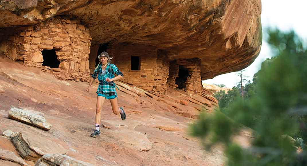
I only occasionally scanned the high canyon walls, and through a small opening in the trees, I spotted a cliff dwelling—walls of artfully crafted sandstone bricks built directly into the rock walls—with windows and wooden beams still intact. I diverted my route from the trail and scrambled up slickrock ledges to pay homage to this portal into the past. Looking through the home’s ancient brick window, I soaked in the lush canyon, blue skies, magnitude, sacredness and beauty of Bears Ears.
Another day, I circumnavigated the iconic North Six Shooter—a 350-foot Wingate-Sandstone butte resembling an upward-pointing revolver atop a huge talus cone—in Indian Creek. On other runs, I crossed barren dry washes on 90-degree days, slogged over sand dunes that filled my shoes with fine red silt, did steep hill repeats up and down the slickrock ridges of Comb Wash with Luke Nelson, ran through box canyons lined with stunning arches, pranced through the aspen groves at 10,000 feet in the Abajo mountains and encountered deer in lush green meadows still scattered with late-spring snow.
Eventually, on a warm, sunny Easter morning I returned to Bears Ears Pass for a redemption run. The six-mile, 2000-foot climb started in a canyon full of high-desert shrubs before ascending through dense piñon-juniper forests. Once between the two buttes I was swept away in panoramic views of deep and winding whitewashed canyons in Natural Bridges National Monument, Monument Valley’s iconic red-rock formations, Comb Ridge, the nearby aspen-covered Abajo Mountains and the more distant La Sal Mountains and La Plata Mountains. Behind me laid the vast pine-covered region of Elk Ridge and Dark Canyon Wilderness. My mind dreamed up endless new-route ideas and adventures, before I turned around and ran back down the mountain.
ADVERTISEMENT
Trailhead: Bears Ears National Monument, Utah
Bears Ears Beta:
For information, permits and local beta, visit the Kane Gulch Ranger Station (managed by BLM) in southwestern Utah along Highway 261, near Natural Bridges National Monument. Essential topo-map zones include the Cedar Mesa/Grand Gulch, Manti-La Sal Forest and Canyonlands-Needles District.
ADVERTISEMENT
Know Before You Go:
Bears Ears is primitive. There are no services in the region, no cell reception and water is scarce. Check the weather and know your game plan ahead of time. Arrive prepared with extra water, emergency gear and a full gas tank. Stop in Blanding, Utah, on the east side of the monument, to
fuel up and carbo-load with
a smothered burrito at
Pop’s Burritos.
Respect the Land:
Amanda Podmore of Friends of Cedar Mesa suggests that trail runners consider removing packs so they do not accidently brush against walls and sensitive areas when approaching a cultural site, and to not run or walk too close to the base of structures to avoid eroding the foundation. And leave all artifacts in place.
When to Run:
Spring and fall are the ideal seasons. Locals profess that the high country (including the Bears Ears) is notorious for snow as late as May or June (but summer temperatures can be scorching). Flash floods are always a serious concern, especially in the canyons. Keep an eye on weather, and with any wilderness trail run be prepared to adjust your plans for the conditions.
ADVERTISEMENT
Recommended runs
Bears Ears
To run the Bears Ears Pass (and beyond), take County Road 263 out of Blanding to Highway 95 until you see the sign to go right for Bears Ears. Park at a pullout and prepare to climb and grind—the views will be worth it!
ADVERTISEMENT
North Six Shooter
The iconic North Sixth Shooter Peak in the Indian Creek region (known for its world-class rock climbing) is a delight to stare up at as you log miles. For a flat, easy eight-mile out-and-back, take State Route 211 to the Jeep road for Davis/Lavender Canyon, which leads to the base of the tower. You may extend the run to include the tower’s climbing approach from the south end of the feature, which involves negotiating talus and scree fields, for dramatic views of the Indian Creek and the Canyonlands Needles District.
Mule Canyon
From County Road 263, take Texas Flat Road past the parking lot and look for the small trailhead sign on the left. The House On Fire Ruin is only one mile in from the trailhead, but the Mule Canyon’s singletrack trail continues along the creek for a possible nine-mile out-and-back run. Keep your eyes open for more ancient sites. Get to The House on Fire by mid-morning to experience the ideal lighting for its roof to truly look ablaze