Published November 16, 2021 02:15AM
Trail Towns: Boise, Idaho
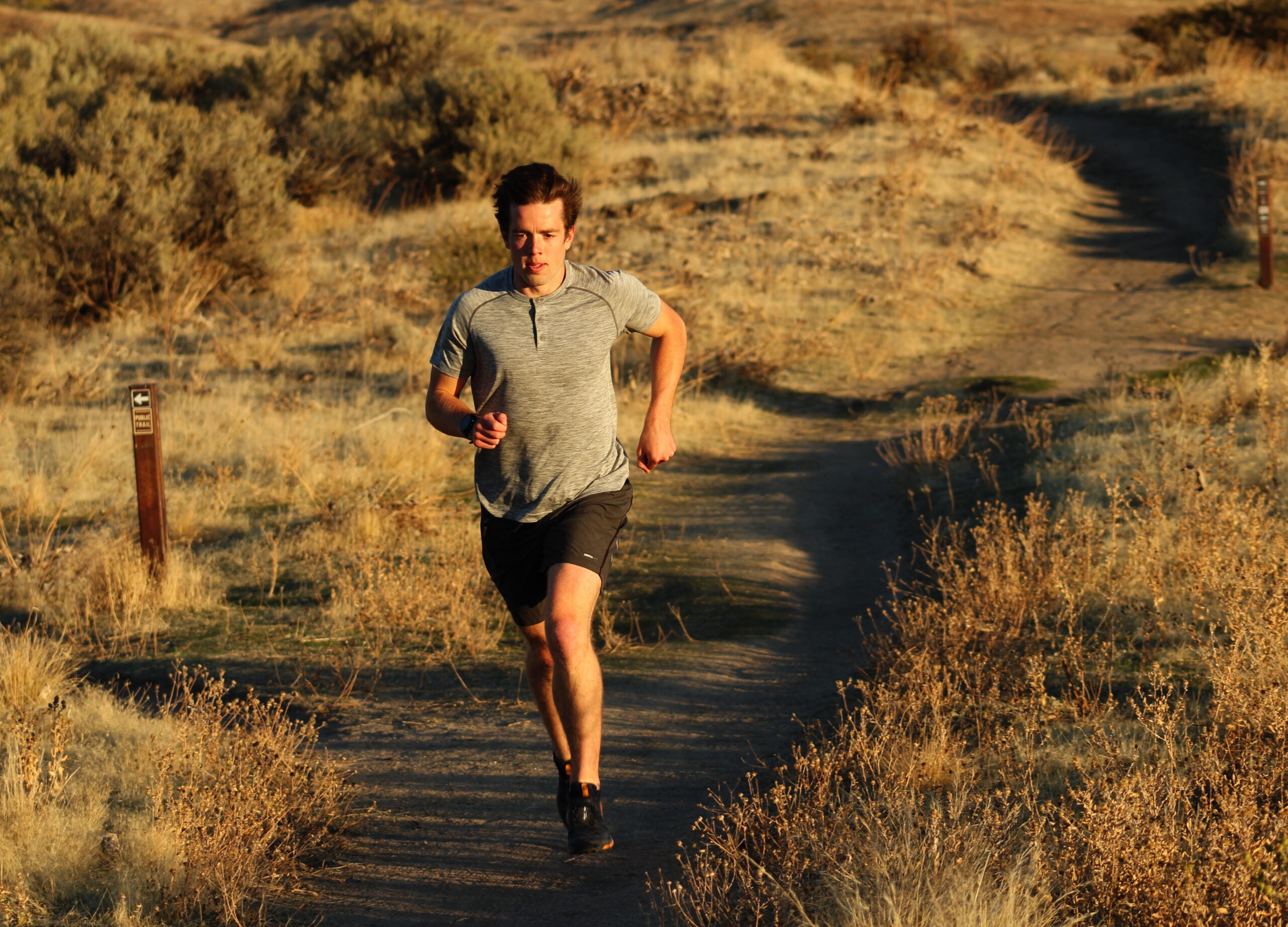
Idaho's capital city might not have mountain-town elevation, but the trail access and alpine desert climate make for ideal trail running.
(Photo: Micah Drew)
Boise (pronounced BOY-see, not BOY-zee) straddles the border of the Rocky Mountains and the Pacific Northwest, meaning Idaho’s capital city is often overlooked as an adventure town. Two common mainstays of popular trail towns — high elevation and rugged ridgelines — don’t exist. Boise sits just below 3,000 feet above sea level and the nearest truly technical terrain is hours away. However, Boise has one of the largest interconnected trail systems in the country, making the city a hidden gem.
More than 200 miles of single-track, most part of the Ridge to Rivers Trail System, start in town and lead into the mountains. The system has more than a dozen access points, most leading directly out of downtown or neighborhood parks.
“Accessibility from downtown is amazing,” says Matt Laye, a coach with Sharman Ultra Coaching and the local Boise Billies trail team. “You can be half a mile from the trails and half a mile from downtown. Everything is runnable for most of the year, and while it’s not going to be super technical, I think that the access just trumps all that.”
The lower trails criss-cross the Foothills surrounding town and range from narrow single track to wide paths, mostly buffed-out dirt with the occasional sandstone boulder. Generally the trails are busiest in the afternoon and early evening, when 9-5ers head out for after-work runs and rides. The mountain biking community coexists happily with runners, although the occasional blind corner can still send your heart rate to another zone.
RELATED: Train for Mountain Running, Even If You Live At Sea Level
The lower foothills are covered in sweet-smelling sagebrush and drought-resistant vegetation that blooms in the spring. The lack of trees throughout the lower trails allows for spectacular views of the Boise valley from almost every bend (and means no need to watch for roots!). Once you get into the hills (or drive to a higher trailhead) the terrain and vegetation shifts to alpine forests that dazzle with color in the fall.
Even without truly technical trails, the rolling hills make it easy to rack up elevation during easy afternoon runs. It’s a common mistake made by transplants to town — you won’t hit a normal pace in the hills, so run by effort until you get used to the constantly undulating terrain.
If you’re in the mood for a real climb, a variety of trails intersect with routes to Bogus Basin ski area, or you can follow the lead of Boise State University cross country coach Corey Ihmels and drive 15 miles to start from the top.
“My favorite is going up to Bogus and running Around the Mountain,” says Ihmels, who sends his athletes to the mountain for long runs during the fall. “You kind of leave the high desert and there’s more tree cover and that’s just an awesome trail. It’s worth the drive.”
Boise has several local running stores, and the city’s trail organization, Boise Trails, has maps, trail conditions, events for runners and bikers and an official beer sponsor, 10 Barrel Brewing.
“You wouldn’t think that you would have all this in a place like Boise,” says Laye. “It’s deceptively good.”
RELATED: A Trail Runner’s Guide to Environmental Justice
ADVERTISEMENT
By the Numbers
0.9 / Miles from the state capitol to the nearest trailhead.
3.4% / Average annual growth rate of the Boise Metropolitan Area between 2010 and 2020.
34.5 / Miles it took local Jackson Brill to climb more than 29,035 feet, known as Everesting, on a single mile-long trail segment. Brill took 15 hours to complete the feat fueled by mocha brownies, sour cream and onion chips and Coke.
116 / Hours it took Alyssa Rogers to cover the 173 miles of trail and 36,000 feet of elevation gain included in the Boise Trail Challenge, which gives participants a month to complete all included trail sections.
7,582 / Elevation of Shafer Butte, the highest point of the Boise Ridge above Bogus Basin Ski Resort.
85,000 / Acres of land covered by the Ridge to Rivers trail system.
ADVERTISEMENT
Plan Your Visit
Play Tourist / Boise is a multi-sport mecca. For the climber, there are more than 100 sport routes in the nearby Black Cliffs and plenty of bouldering routes. Boise River Park offers kayakers and surfers a place to play on the river, and you can’t go wrong with the Boise Green Bike share system, which provides a way to explore town on the 25-mile Boise River Greenbelt.
Recovery Beer / Boise is solidly on the craft beer bandwagon. With more than 20 craft breweries, head to a taproom like Highlands Hollow off the Hillside to Hollow trailhead or Payette Brewing Company along the river.
Eat Up / After a morning run, you need good coffee and a hearty breakfast. Find both at Big City Coffee, which specializes in plate-sized pastries. For a mid-day meal, Kibrom’s offers Ethiopian and Eritrian fare that fills any post-run craving. Bittercreek Alehouse in the heart of downtown emphasizes sourcing from local farmers and growers and has an extensive beer list as well as a late afternoon happy hour for quick bites and drinks.
ADVERTISEMENT
Trails
-
- Polecat / A 6.5 mile loop with a north and south trailhead for easy access. Link them together for a 14+ mile ascent to the ski basin.
- Table Rock / The most popular trail in Boise on any given weekend leads to the top of an iconic plateau with views of downtown and is a classic sunset-viewing spot. The main trail rises 900 feet in just under two miles, but for a true challenge, take the Tram Trail up the back, which averages a 20% grade over the last half mile.
- Dry Creek / A 12-mile lollipop loop that follows a creek up into the foothills before hopping over the ridge and descending along a tributary.
- Camel’s Back Park / This park and trailhead abuts the historic Hyde Park neighborhood and offers access to dozens of trails within the Ridge to Rivers system.
- Around the Mountain / From the base lodge at Bogus Basin, link the Deer Point, Around the Mountain and Morning Star trails for a 9.5 mile loop around Shafer Butte.
- Stack Rock / A 500-foot granite tower that juts from the forest can be reached via a four-mile trail off Bogus Basin Road, a nine-mile trail from the ski resort or an 11-mile climb up Peggy’s and the Sweet Connie trail from the city limits.
Races
Resort to Rock / With 50k, 32k and 10-mile options with roughly 7,400, 4,400 and 1,600 feet of climbing respectively, there’s a race for everyone. Single-track courses start at Bogus Basin Ski Resort and loop around the mountain.
https://www.pulserunning.com/resort-to-rock-ultras
Foothills XC12k / This short, competitive race connects popular single tracks in the lower hills and includes nearly a thousand feet of climb in the first half—with cash incentives to hammer from the start as the first male and female to the top earn a payday. https://www.bbnt.ski
Race to Robie Creek / No race gives bragging rights like Robie. The Rocky Mountain Sail Toads have organized the ‘toughest race in the Northwest’ up and over Aldape Summit since 1975.The half marathon starts on the edge of Boise and ascends 2,072 feet up Rocky Canyon before dropping down the other side to finish at Robie Creek Campground. Each edition centers around a theme, including “Shakespeare’s Robie or not Robie,” “Plunderin’ fer Booty,” and “A Race Odyssey.” https://runsignup.com/Race/ID/Boise/RacetoRobieCreek
Micah Drew is a contributing writer for Trail Runner. He writes and runs in western Montana.