Published September 14, 2016 07:41PM
Coming Soon to Your Living Room: A Virtual Version of the Western States Course
Many trail runners aspire to one day run the Western States Endurance Run, the world’s oldest 100-mile trail race. In the meantime, Western States hopefuls, along with armchair ultrarunners everywhere, will have a way to experience the iconic California race from the comfort of home—well, sort of.
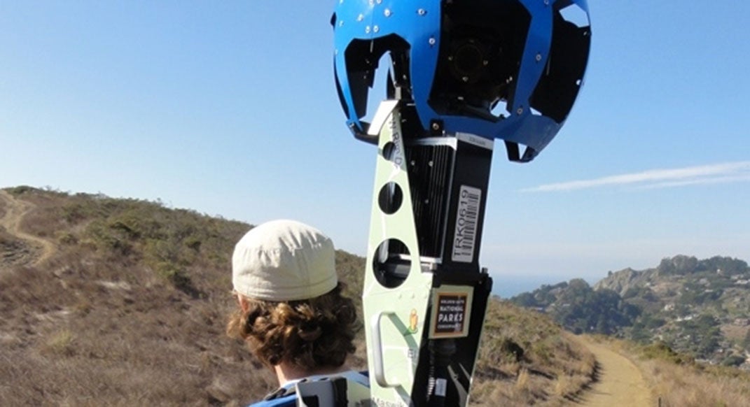
Beginning on June 20, a team of trail runners will hike the entirety of the Western States course, from Squaw Valley to Auburn, carrying a Google Maps Trekker. The Trekker is a backpack-mounted camera system that captures 360-degree panoramic imagery. Just as Google Street View captures roads and businesses in cities and suburbs, the Trekker, complete with 15 cameras and a GPS, captures remote areas, such as trails in national parks and other places accessible only by foot.
The team, led by Richard Bolt, the Director of Online Marketing for the American Trail Running Association (ATRA), will consist of three or four trail runners. Over the course of four or five days, they’ll alternate carrying the 40-pound Trekker backpack to record images of the trail. Once the footage is processed, anyone will be able to experience, virtually, what Western States runners see on race day.
ADVERTISEMENT
Since the summer of 2015, Google Maps has extended the use of its Trekker to third-party organizations through an online application process, allowing tourism and research groups, university clubs and non-profits to capture and share footage around the world. Bolt had been watching results of the program for the past three years, and jumped at the chance to put in an application.
“Home of the most well-known and iconic ultra-distance trail-running race in North America, Western States seemed like the obvious choice of trails to image using Google’s Trekker,” he says.
Since it will take four to six weeks to process the imagery, Bolt says it should go live around early August and will be able to be viewed on ATRA’s Western States Trekker page, the Western States 100 website and trailrunproject.com. Bolt and other project members will also be at the Western States expo on Friday, June 24, with the trekker backpack to show runners and fans.