Published August 12, 2019 02:32PM
12k' Plus Routes in Rockies
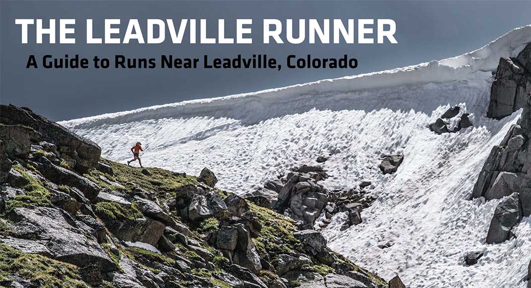
It doesn’t get much better than running high in the mountains, particularly if you aren’t threatened by thunderstorms. The routes in this section frequently include long off-trail sections with a substantial amount of time spent above 12000 feet.

NORTH SAWATCH 12K’ PLUS
It doesn’t get much better than running high in the mountains, particularly if you aren’t threatened by thunderstorms. The routes in this section frequently include long off-trail sections with a substantial amount of time spent above 12000’, so plan your time accordingly.
LA PLATA — HOPE PASS
Next time you are planning to do laps on Hope Pass as training for the LT100, consider this route for a littel variety and more climbing.
THE ROUTE
Starting from the La Plata Gulch Trailhead on Highway 82, follow South Fork Lake Creek road for about a quarter mile, then turn left onto the well marked La Plata Peak Trail. Just after four miles on the trail, you’ll summit La Plata Peak, the fifth highest peak in Colorado.
ADVERTISEMENT
Follow the south ridge of La Plata for a mile where there is difficult terrain over boulders. Then turning southwest, the trail meets up with the North Fork Clear Creek for 3.7 miles.
The trail joins up on the Continental Divide Trail (CDT) near Winfield and turns northwest for 5.4 miles towards Hope Pass.
Continue on the CDT for 2.6 miles where there is a trail on the left towards Willis Lake for an additional 3 miles out and 3 miles back.
Back on the main trai, itl continues north for 1.8 miles towards Willis Gulch and finishes on Highway 82 just west of Twin Lakes.
ADVERTISEMENT
INDY PASS
It’s not just skiers who can take advantage of gravity fed recreation on Independence Pass; there are a variety of fun ridge runs you can do by starting at the pass and ending in the valley below.
THE ROUTE
Starting at the Independence Pass parking lot on Highway 82, head south on the prominent trail following the Continental Divide for 1.3 miles.
ADVERTISEMENT
Then skirting the ridge to avoid 4th class climbing and loose rocks for 1.6 miles. At Mountain Boy, follow the ridge for another 1.9 miles.
The route then turns east off the ridge and down into Graham Gulch for 3.2 miles on the north side of Ouray Peak, which eventually leads back to Highway 82.
There are additional opportunities on the north and south end of the trails to get extra mileage and stunning views.
To the north of Independence Pass, there is a ridge run towards Twinning Peak and around Blue Lake for 4.5 miles. Then turning back south, the route follows North Fork Lake Creek Trail for 2.4 miles and ends at the North Lake Creek Trailhead.
To the south, the alternate route takes you around and to the south side of Ouray Peak. The trail takes you to the Ouray Peak Trailhead on South Fork Lake Creek road. Heading northwest, the additional route ends at the La Plata Gulch Trailhead on Highway 82.
ADVERTISEMENT
MASSIVE TRAVERSE
The traverse of Mt. Massive has become a classic run/hike with many variations. The version of the traverse pictured here is superb and provides a relatively quick and easy route to the ridge from the Windsor Lake trailhead.
THE ROUTE
Starting at the Windsor Lake Trailhead on Forest Road 105, follow the route 1 mile out to Windsor Lake and then 2 miles up to the Continental Divide ridge where the route is bouldery and slow.
ADVERTISEMENT
The route continues south on the ridge for several miles and takes a turn southeast towards North Massive Peak. The route summits Mount Massive after .9 miles.
Following the ridge southeast for 2.6 miles the route then turns northeast for 1.3 miles until it meets up with the Continental Divide Trail. Following the CDT for several miles north, the route then takes a sharp turn to the east and ends at the Leadville National Fish Hatchery after 2.7miles
There are numerous trails that offshoot from the Massive Traverse Route. Additional options include either making the traverse shorter by following the Mount Massive Trail after summiting Mount Massive, or there is the possibility of looping back towards Native Lake Trailhead and running 4.8 miles north on the Highline Trail.
GALENA — HOMESTAKE
The ridge between Galena and Homestake is one of the more runnable sections of ridge in the Leadville area.
ADVERTISEMENT
THE ROUTE
Starting at the Timberline Creek Trailhead on Turquoise Lake road and just northwest of Turquoise Lake, the route follows the Continental Divide Trail north for 1.9 miles and then turns off the CDT and to the north for 1.7 miles to the top of Galena Mountain.
The route continues on the ridge for 4.9 miles to Homestake Peak. The route follows down the east ridge of the peak, which involves slower rock hopping, for 1.5 miles eventually turning north and coming to Slide Lake.
ADVERTISEMENT
At the lake, the route follows the trail east for .7 miles towards the Tenth Mountain Division Hut. The route follows along Mountain Road 145 and ends at the junction at County Road 19.
There are two options to extend the route on the Galen-Homestake Ridge.
After running down from the 10th Mountain Hut, the route can loop back to Timberline Creek Trailhead with an additional 8.4 miles on the CDT.
An additional route off the top of Homestake Peak follows the peak’s north ridge for 2.8 miles around the Slide Lake Basin and ends at the 10th Mountain Hut.
—Justin Talbot is a photographer living in Leadville, Colorado. His book, The Leadville Runner highlights some of his favorite trails near Leadville. He has upcoming book signings on Wednesday August 14th at 5pm at Leadville Outdoors and Thursday August 15th at 5pm at the REI in Dillon.