Published August 31, 2017 03:07PM
The Urban Trail Runner's Guide
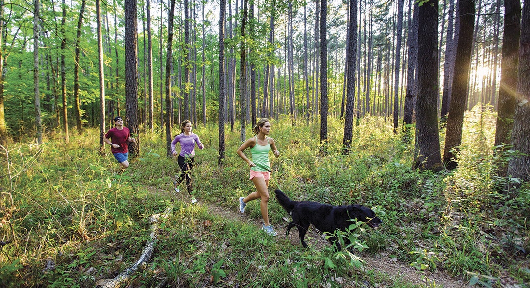
Lobo, Jaimee Cox, Annie Fletcher and Justin Thomas, Section 9, Big Creek. Photo by Chad Ehlers/auroraphotos.com.
Urban sprawl doesn’t have to equal running pavement. Even near the United States’ largest urban areas, bucket-list-caliber trails await those seeking sublime singletrack, solitude and adventure.
Here we highlight some of the wildest, longest and most rugged trails accessible within an easy day’s drive of America’s five largest cities. Want to escape the sprawl and tick off a run of a lifetime? Here’s your list … now, get running.
Houston
Lone Star Hiking Trail
129 miles / 1-hour drive from Houston
The Sam Houston National Forest is a 255-square-mile wilderness offering big-time solitude a mere 50 miles from the sprawling city of Houston. The Lone Star Hiking Trail is “the thread that ties together [it’s] multifaceted woodlands,” says Cathy Murphy, 69, of Houston, and member of the Lone Star Hiking Trail Club.
ADVERTISEMENT
Along the trail, expect flat, fast-moving terrain with some wet areas with boardwalks and bridges. The easy nature of the path allows you to take in the views of tall, dense pine forests, grand magnolia trees, stunning wild flowers and scenic lakes like the 21,000-acre Lake Conroe.
On a well-timed spring run on the nine-mile Magnolia Section, you’ll be treated to an overwhelming explosion of large white blossoms of the magnolia trees lining the trail, creating a fairytale scene.
More Trails
Memorial Park Trails / 20-plus-mile trail system
Memorial Park has the best singletrack trails inside the Interstate 610 ‘Loop’ in Houston. The trails are busy on weekends and after work, but it’s hard to find better trails smack dab in the middle of a big city.
Huntsville State Park / 14-mile trail system
Huntsville State Park is a piney-woods park an hour north of Houston in the Sam Houston National Forest. Its trails wind around Lake Raven, a small reservoir. The park hosts many great trail races including the iconic Rocky Raccoon 100-Mile and 50-mile.
Lake Houston Wilderness Park / 58-plus-mile
trail system
The heavily forested park is located 30 minutes north of downtown Houston near the town of New Caney. Peach Creek Trail (four miles one way) makes a great out-and-back, with scenic creek views.
ADVERTISEMENT
Insider’s Scoop
Season
Fall, winter and spring are best. Summer months bring the Texas heat, biting flies, ticks and mosquitoes.
Camping and Accommodations
From Houston, the closest towns with hotels are Conroe and Willis, or try Huntsville, just north of Sam Houston National Forest. Best campgrounds are Stubblefield and Double Lake. Primitive camping is allowed in many areas except during deer-hunting season when camping is limited to campgrounds.
Refuel
For local flavor and big portions, hit up Hidden Gem or Fish Pond Restaurant in Willis or head to the big city (Houston) for more options.
Resources and Gear
The handy Lone Star Hiking Trail-Maprika Maps (lonestartrail.org/maprika.html) for your smartphone can’t be beat or grab Karen Borski Somers’ guide The Lone Star Hiking Trail: The Official Guide to the Longest Wilderness Footpath in Texas. The Lone Star Hiking Trail Club (lonestartrail.org) has regularly updated information about trail conditions, water sources and more. Hit up On The Run (ontheruntx.com) in Houston for gear.
Play Tourist
Mountain bike at Double Lake Recreation Area and Huntsville State Park, paddle on Lake Conroe or kick back on Southern Empress Cruises, also on Lake Conroe.
ADVERTISEMENT
By the numbers: Lone Star hiking trail
129 – The length of the LSHT, the longest continuous hiking trail in Texas.
1978 – Year the trail was finished, the trail was conceived 12 years earlier by the lone star chapter of the sierra club, but many hands have helped in it’s building. Including the Sierra Club and Boy Scouts of Canada.
15– Total trailheads, offering many possible out out-and-backs and variations.
ADVERTISEMENT
Los Angeles
Joshua Tree National
Park Traverse
37 miles / 2.5-hour drive from Los Angeles
The surreal, high-desert Joshua Tree National Park Traverse (otherwise known as the California Riding and Hiking Trail) wanders through heaping boulder piles and wacky-limbed Joshua trees in landscapes straight out of The Flintstones and Dr. Seuss.
ADVERTISEMENT
The Joshua Tree Traverse traces generally non-technical, well-marked singletrack with moderate elevation changes, but planning well is essential. Christof Tuescher, 44, of Portland, Oregon, battled super-cold temperatures on his unsupported double traverse of the Joshua Tree Traverse (19 hours 23 minutes 37 seconds). “Luckily I had planned ahead well and had plenty of layers. Otherwise I’d have been in trouble,” Tuescher says.
Tuescher’s favorite section of the Joshua Tree Traverse is Upper Covington Flat, where “things start to feel much more remote and rugged.” This lonely section follows spectacular desert plateaus and ridges and drops into secluded dry washes amid armies of Joshua trees, oceans of dome-shaped rocks and expansive views of craggy Quail Mountain, the highest point in the park at 5,813 feet.
insider’s scoop
Season
Fall, winter and spring are best. March-April is wildflower season. Summers are dangerously hot.
Camping and Accommodations
Joshua Tree National Park has great campground options, the best being Hidden Valley, Ryan and Jumbo. Just north of the park, the small towns of Joshua Tree and Twentynine Palms offer hotel options.
Refuel
The town of Joshua Tree has a hip little downtown strip. Crossroads Café has great vegan and organic food options, a juice and smoothie bar and baked goods. Natural Sisters Café offers high-quality traditional café food; Joshua Tree Coffee Company is a must visit with nitro cold brews; and Pie For the People serves up great post-run pizza.
Resources and Gear
Two great trail-running clubs in the LA area are Santa Monica Mountain Goats and the Trail Runners Club. Check out A Runner’s Circle in Los Angeles
for gear.
Play Tourist
Rock climb, hike or just lie on a big rock in Joshua Tree National Park. Just north of the park, visit the one-of-a-kind wooden-domed Integratron—an electrostatic generator originally designed for the purpose of rejuvenation and time travel. Hit Palm Springs for golf, spas and a scenic tram, or truck it to LA for beaches, Hollywood and more.
ADVERTISEMENT
more trails
Mount Hollywood-Griffith Park / 53-mile trail system
Griffith Park is one of the largest urban parks in North America, spanning over 4,300 acres … and it’s covered in trails. Hit up the standard classic route from the Observatory parking lot to the summit of 1,625-foot Mount Hollywood or explore the web of singletrack side trails up canyons and ridges.
ADVERTISEMENT
Santa Monica Mountains / 500-mile trail system
The coastal Santa Monica Mountains National Recreation Area, located west of LA, offers one of the crown jewels of Southern California, the Backbone Trail. The 67-mile footpath winds along interior ridge lines with astounding views of surrounding mountains, valleys and the neighboring Pacific Ocean.
Angeles National Forest San Gabriel Mountains / 700-mile trail system
Jutting skyward northeast of LA, the San Gabriel Mountains offer real-deal mountain running only an hour drive from the city. Tagging the summit of Mt. Baldy, the highest peak in LA County at 10,064 feet via the 13-mile roundtrip Bear Flat Trail is a must. Also, hit up the many other summits in the Angeles National Forest or run sections of the Pacific Crest Trail.
ADVERTISEMENT
By the numbers: Joshua Tree National Park traverse
5.74 – The average annual rainfall in inches in Joshua Tree National Park, making it one of the driest areas in California.
4 Hours 49 Minutes– The unsupported single-crossing FKT, set in March 2017 by Micheal Carson.
790,000– Acres comprising Joshua Tree National Park, which is slightly larger than the state of Rhode Island.
ADVERTISEMENT
Chicago
Ice Age Trail
1,200 miles / 2-hour drive from Chicago
The Ice Age Trail winds its way in the loose form of a 1,200-mile cursive “v”, tagging 30 of Wisconsin’s 70 counties. The trail traces endless moraines, eskers, drumlins, kettles, erratics and kames carved out by Wisconsin’s last glacial advance over 10,000 years ago.
Phelps/auroraphotos.com.
Along the endless hills and valleys, you’ll find “a good supply of rock, roots and hummocky terrain,” says Jason Dorgan, 50, of Madison, Wisconsin, who has run the classic Ice Age Trail 50-Miler 17 times. Twisting an ankle on this technical trail can lead to a lengthy escape, especially in Northern Wisconsin where cell coverage is hit or miss. If running in the Chequamegon National Forest section, says Dorgan, “You are simply meant to be alone.”
ADVERTISEMENT
As a reward for the rugged terrain, you’ll take in the unique diversity and beauty of prairie, mature woods, stunning bluffs, ridges and rushing rivers. Jeff Mallach, 56, of Hartland, Wisconsin, and race director for the Ice Age Trail 50-Miler since 2009, recalls one of his most memorable runs: On the Loew Lake section of the Ice Age Trail, along the Oconomowoc River, he “was buzzed by a mother owl, passed a tree with three baby raccoons, scattered a flock of wild turkeys, hurdled a large snapping turtle and saw six whitetail deer.”
More Trails
Rock Cut State Park / 3-mile trail system
An hour northwest of downtown Chicago, Rock Cut offers rolling terrain, two lakes and rocky outcroppings.
Palos Trail and Sag Valley Trail systems / 60-plus-mile trail system
Located in the southwest suburbs about 30 minutes from downtown Chicago, “These trails are hilly, delightfully rugged and can lead down remote paths. They are my hands-down favorites,” says Bill Thom, 56, of Chicago, and proprieter of RunRace, a running registration and timing service, and six-time Western States finisher.
Des Plaines Trail / 58-plus-mile trail system
Just west/northwest of downtown Chicago, it winds along the Des Plaines River all the way to the Wisconsin border. ”In Cook County, the trails are more rugged, sometimes choppy, occasionally eroding, while in Lake County, they are well-maintained, consistent and marked with mile posts,” says Thom, who uses the trails as his training ground for his annual pilgrimage to Western States.
ADVERTISEMENT
Insider’s scoop
Season
Spring and fall are best. Summer is often buggy and humid. Winter is cold with snow.
Camping and Accommodations
LaGrange is a great diving board for some of the best sections of the Ice Age Trail in the Kettle Moraine State Forest-Southern Unit and has great options for camping and hotels.
Refuel
In LaGrange, Backyard Bikes has “a great outdoor area and really good healthy sandwiches that you can wash down with several local beer options or even wine,” says Dorgan. Rushing Waters Trout Farm and Restaurant has a varied menu, and is also “the site of the IAT50 Mile packet pick-up,” notes Mallach. The LaGrange General Store rounds out the great options with deli sandwiches, salads, smoothies, ice cream, local microbrews and bottled wine.
Resources and Gear
The best online resource is the Ice Age Trail Alliance (iceagetrail.org). Fleet Feet has multiple locations in Chicago for gear.
Play Tourist
Devils Lake State Park offers magnificent views from 500-foot quartzite bluffs overlooking a crystal-clear lake, along with swimming beaches, rock climbing and mountain biking. The Kettle Moraine State Forest-Southern Unit near LaGrange has excellent mountain biking, swimming, hiking, boating, kayaking and fishing. For big-city fun, you can’t go wrong in Milwaukee or Chicago.
ADVERTISEMENT
By the numbers: Ice Age trail
1980– The year that the Ice Age trail was established by an act of congress, making it a National Scenic Trail.
22 Days 6 Hours– The current Fastest Known Time, set by Jason Dorgan in Arpil 2007 on the then – 1,079- mile trail (it has since been expanded by 120 miles).
70,000-Number of volunteer hours logged by the Ice Age Trail Alliance.
ADVERTISEMENT
New York City
Shawangunk Ridge Trail
71 miles / 2-hour drive from New York City
The Shawangunk Ridge Trail (SRT) stands in contrast with southern New York’s typically dense forest. It travels along a seemingly endless, jutting ridgeline of tall white stone with vistas of rolling hills covered in hardwood forests, shimmering lakes and vast wetlands. Kenneth Posner,
53, of New York City, and race director of the uniquely self-reliant (read: no aid stations or course markings) SRT Run/Hike says that “at one point you can look back 40 miles to the Monument Tower at High Point State Park in New Jersey … and then turn around and look 30 miles to the Catskills in the north. Posner adds that “at the high point in the Shawangunks, there are 100-plus-mile views.”
ADVERTISEMENT
Aside from bears (Anna Pettersson, 48, from Manhattan and the female winner of the SRT Run/Hike 70-miler in 2015 has had multiple sightings), the trails have a couple of other hazards. Pettersson explains that ”in places the trail runs very close to a cliff edge with just open air beyond. In other places, [like in Mohonk Preserve], there are crevices where puffs of cold air shoot up as you wander by.”
One of the most dreamy and diverse sections of the Shawangunk Ridge Trail is Sam’s Point to Rainbow Fall in Minnewaska, which delivers “stunning views, waterfalls, rock scrambles, enchanted gnarly pine forest and some lovely stretches with huckleberry bushes and soft dirt trail that just cries out to be run on,” says Pettersson.
Insider’s Scoop
Season
Mid-October is prime, with spectacular fall colors. Spring can be wet and buggy. Summer is hot, humid and buggy. Winter is cold with snow.
Camping and Accommodations
Samuel F. Pryer III Shawangunk Gateway Campground is a favorite. Hotels can be found in the nearby town of New Paltz.
Refuel
A favorite of Posner’s is Aroma Thyme Bistro in Ellenville; he notes that the chef is “a trail runner … and a big supporter of the trails, and it’s our go-to place to relax after a long day running.” Pettersson’s favorite greasy spoon is the Mountain Brauhaus, close to the end of the Shawangunk Ridge Trail. They have an “outrageously yummy take on a Reuben sandwich and great beer varieties as well,” she says.
Resources and Gear
Great information on the trail can be found at www.nynjtc.org/region/shawangunk-ridge-trail. Find out more about the self-supported SRT Run/Hike at srtrunhike.com. Go to Brooklyn Running Company or Jackrabbit locations for gear.
Play Tourist
Rosendale, where the Shawangunks Ridge Trail ends, offers cute restaurants and bed & breakfasts. In particular, the 1850 House in Rosendale is a quaint upscale hotel with a pub/restaurant offering “friendly staff and a menu perfect for filling the post [run] void in the belly,” says Pettersson. Also, check out the world-class rock climbing while at the Shawangunks.
ADVERTISEMENT
More Trails
The Long Path / 350 miles point to point
The Long Path, which stretches 350 miles from New York City to the John Boyd Thacher State Park just west of Albany, resembles a miniature version of the Appalachian Trail. Says Posner, “There are dozens of cool places along the trail for day runs.”
ADVERTISEMENT
Sterling Forest / 83-mile trail system
Sterling Forest offers a mixture of technical trails and woods roads. “Some sections around [Sterling] Lake are truly stunning,” says Pettersson.
Bear Mountain and Harriman State parks/ 100-mile trail system
Bear Mountain and Harriman State parks have an incredible combined trail system due to “great terrain and great challenge, and not being over-run by people most of the time,” says Pettersson, noting that her go-to trail experiences are Bear Mountain, “looping around Doodletown and cruising along the Ramapo Dunderberg or Timp-Torne trails,” or Harriman, “trotting around Silvermine Lake, via Owl Swamp and Black Mountain.”
ADVERTISEMENT
By the numbers: Shawangunk Ridge Trail
2,289-Maximium elevation in feet of the Shawangunk Ridge, near Lake Maratanza.
200-Number of bird species found at the Bashakill, which is southern New York’s largest wetlands and located along the Shawangunk Ridge Trail.
8– The tallest of the rare dwarf pine barrens (in feet) blanketing the Shawangunk Ridge tops.
ADVERTISEMENT
Philadelphia
Mason-Dixon Trail
199 miles / 1-hour drive from Philadelphia
The Mason Dixon Trail loosely follows the line that separated the northern states from the southern states in the 19th century. This area of Pennsylvania, Delaware and Maryland has since become a densely developed landscape. It is fortuitous that such a scenic and sometimes very wild and rugged footpath now traces its length through this web of rural lands, towns and cities. Destire Cossaboom, 35, of Newark, Delaware, who has logged numerous miles on the Mason-Dixon Trail, notes that the solitary and sublime singletrack sections are “interspersed between road sections that remind you that you aren’t all that removed from society after all.”
ADVERTISEMENT
Run the historic trail and be rewarded with views of rolling hills thick with lush forests intertwining expansive grass fields, rivers, streams and waterfalls. In particular, “Experience breathtaking views of waterfalls and the large Susquehanna River, and see the stunningly serene sections [of] White Clay Preserve and White Clay State Park,” says Cossaboom.
Cossaboom’s favorite section is from Peavine Island to about eight miles past Lock 12. Cossaboom says that Peavine Island features “gorgeous singletrack trail, with water crossings over boulders,” adding, “often, kayakers can be seen weaving in and out of the rocks.” Farther past Lock 12, run past a stunning waterfall and up calf-busting switchbacks en route to high rocky outcrop views and then finally reach Powerline Vista, which offers expansive views of the Susquehanna River and the engineering marvel Holtwood Dam.
Insider’s Scoop
Season
Spring and fall are best. Summer can be hot, humid, buggy and offer an abundance of stinging nettles. Winters are cold with snow.
Camping and Accommodation
mason-dixontrail.org/backpacking_info/camping_info.html has excellent camping info for points along the Mason-Dixon Trail. Hotels can be found in many towns along the trail.
Refuel
The Mason-Dixon Trail passes through Newark, Delaware, on the outskirts of the University of Delaware campus. Great post-run food and drink options abound right on Main Street in Newark, such as the Stone Balloon Ale House and Iron Hill Brewery. Cossaboom’s favorite post-run recovery snack is a hand-crafted frozen espresso drink and a bagel from the main street coffeehouse Brew Ha Ha, also offering fresh sandwiches
Resources and Gear
Go to mason-dixontrail.org for detailed trail information. The Wissahickon Wanderers is the local running club.
Play Tourist
Explore Philadelphia and its wildlife preserves, or escape to nearby beaches in both New Jersey and Delaware.
ADVERTISEMENT
More Trails
Appalachian TraiL / 2,180 miles
Pick any Appalachian Trail-Pennsylvanian trailhead and you won’t be disappointed … at least if you’re looking to test yourself on some of the trail’s most rocky and rugged sections. This distinction has gained Pennsylvania the moniker “Rocksylvania.”
ADVERTISEMENT
Wissahickon Valley Park Trail System / 50-plus-mile trail system
In northwest Philadelphia, find a challenging, rugged, forested trail system in Wissahickon Valley Park. “There are tons of great running trails, some of which almost make you forget that you are just a stone’s throw from a city street,” says Cossaboom.
White Clay Creek State Park Trail System / 7-mile trail system
A short drive south from Philadelphia is White Clay Creek State Park in Newark, Delaware, which features forested singletrack trails. Cossaboom notes that “the Mason-Dixon Trail actually passes through this gorgeous park as you cross over the Pennsylvania line through White Clay Preserve.”
ADVERTISEMENT
By the numbers: Mason-Dixon Trail
70-Percentage of the 199-mile Mason-Dixon Trail that is actual dirt trail.
200-Number of years after the original Mason-Dixon Trail line was laid out in 1767 that the Mason-Dixon Trail was conceived by York County, Pennsylvania, native Bob Yost.
3 Days, 12 Hours, 40 Minutes – FKT of the complete Mason-Dixon Trail, set by Paul Melzer in October 2008.