Published September 13, 2018 02:40PM
Favorite Trail: Bulldog Trail
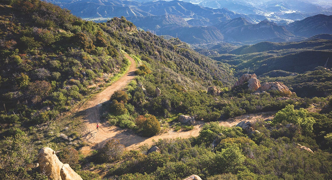
Photo by James Kao
Runner: Claire Walla, 33, of Camarillo, California
Beta: Tucked away in the giant ripples of sandstone and chaparral that tower over Malibu Creek State Park, the Bulldog Trail is a sustained climb with sweeping views of the Santa Monica Mountains. The 3.5-mile trail covers 1,700 feet of gain, but your total mileage for an out-and-back run will hit double digits, as there’s a two- to three-mile approach to the trailhead (depending on where you start your run).
Once you get to the top of the Bulldog Trail, you’ll see a sandy hill, covered in chaparral—but this is not the view you came for. While it’s tempting to turn around and fly back down Bulldog, or take the Castro Motorway down to link-up with the Backbone Trail … wait! Spend some time exploring the ridgeline. Hop 20 feet up that chaparral-covered hill for some awesome views of the Pacific Ocean. Or, turn around, cross over the trail and scramble up the sandstone to the top of Castro Peak, which, at 2,826 feet, is the highest point in the middle section of the Santa Monica Mountains. Castro Peak used to house a fire lookout tower, so it’s got primo panoramic vistas.
ADVERTISEMENT
Pro Tip: The Bulldog Trail is pretty easy to follow, but it does branch off in a couple of places. When you get to a fork in the road, keep in mind that the Bulldog Trail is less overgrown than its tributaries.
Distance: 11-plus miles.
Season: All seasons!
More Info: trails.lacounty.gov/Trail/106/bulldog-motorway